 F-2 MISSIONS
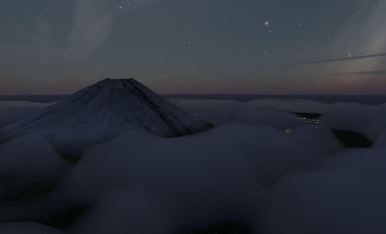
Mount Fuji
Japan's 3,776 m peak, built at survey scale. You can orbit the foot of it — or climb the south face and drop through the summit crater.
DATA
- Location
- Shizuoka and Yamanashi prefectures
- Area built
- 16.0 km square
- Elevation
- 519 m to 3,773 m (measured)
- Highest point
- Kengamine, 3,776 m — the highest in Japan
Japan’s most famous mountain, from an angle nobody gets to see it from.
The place
On the border of Shizuoka and Yamanashi prefectures. At 3,776 m it is the highest mountain in Japan, and a free-standing cone with nothing nearby to compete with it. Its skirt spreads about 40 km across.
The measured elevations run from 519 m to 3,773 m — meaning the elevation data carries the mountain cleanly all the way to Kengamine’s real 3,776 m.
The terrain we built
16.0 km square — twice the span of the gorges, because the subject is larger: Kurobe fits in 7.9 km square, while Fuji needs that much before it is a mountain at all.
The summit crater is in there too. The rim, and the bowl dropping away inside it. Because this is survey data, even the irregularity of the crater lip exists as terrain.
What it is like to fly
There are two ways to do it.
Go around. Come at it from the south and work around the mountain down at the height of the skirt, one wing always over the slope. It is the clearest lesson there is in what flying a contour line actually means.
Go over. Climb the south face and sink into the crater. You get to see the inside of the summit bowl from an angle that is simply not available from the ground.
Skies in F-2 MISSIONS are computed from atmospheric scattering. Twilight seen from 3,776 m, or a summit standing alone above a cloud deck, is calculated fresh from the time of day and the weather each time you fly.
The terrain included varies by edition and platform. See the description of each edition for details.
Elevation data: Geospatial Information Authority of Japan (GSI)