 F-2 MISSIONS
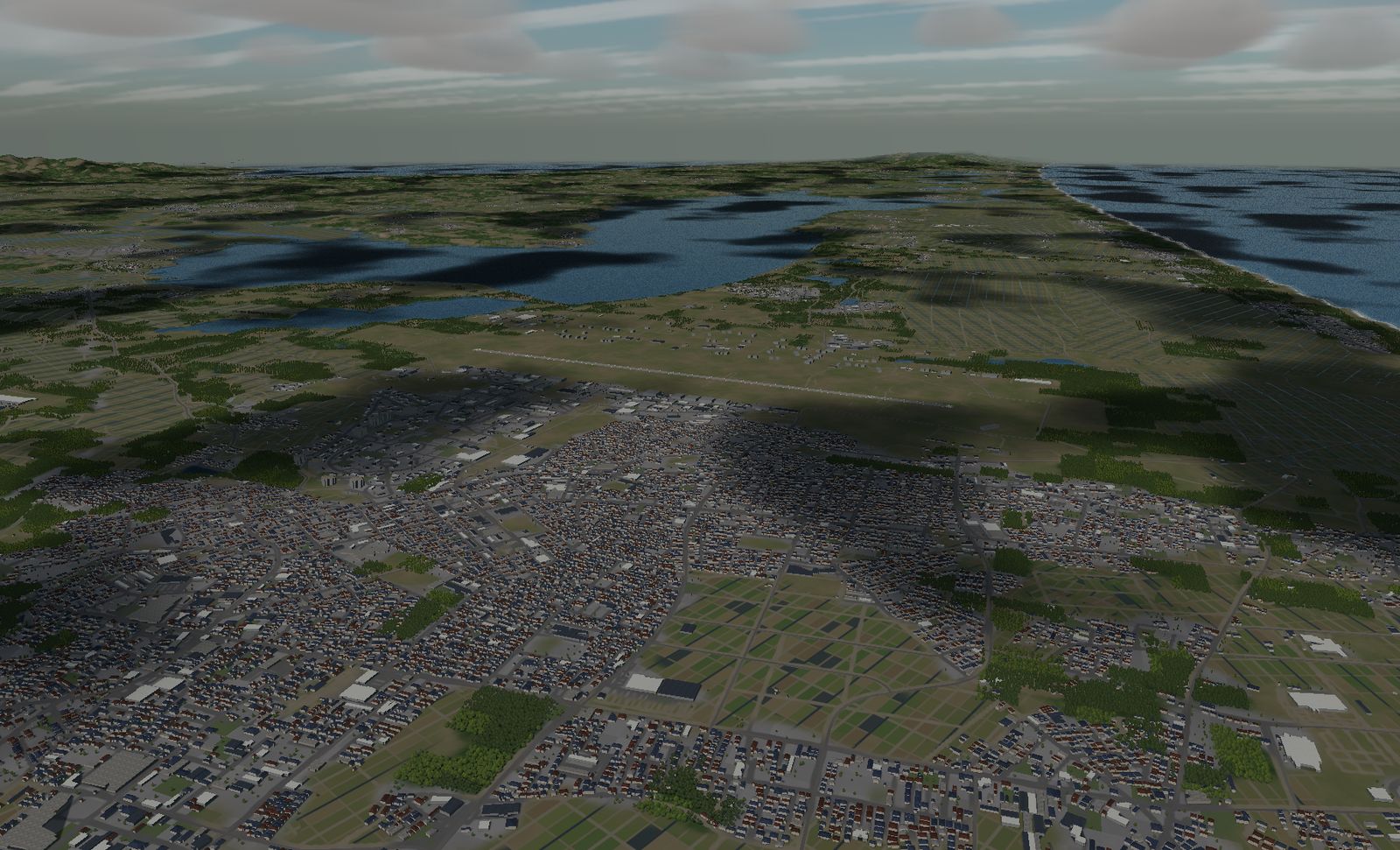
Misawa Air Base
A 3,048 m runway shared by the JASDF, the US Air Force and scheduled airline traffic. Take off and the Hakkōda mountains are dead ahead.
DATA
- Identifier
- RJSM / JASDF Misawa Air Base
- Runway
- RWY 10/28 — 3,048 m × 45 m
- Elevation
- About 34 m
- Based units
- JASDF 3rd Air Wing, 301st / 302nd Sqn (F-35A)
601st Sqn (E-2C)
USAF 35th Fighter Wing, 13th / 14th FS (F-16CJ/DJ) - Area built
- 16.7 × 20.4 km
- Buildings
- 35,530
One runway, three users: the JASDF, the US Air Force, and scheduled airline flights. It is also a name you cannot avoid when following the history of the F-2.
The real base
Misawa, Aomori prefecture. The JASDF’s 3rd Air Wing (301st and 302nd Squadrons, F-35A) and the 601st Squadron with its E-2C airborne early warning aircraft share the field with the USAF’s 35th Fighter Wing (F-16CJ/DJ). The civil side operates as Misawa Airport.
Two F-2 squadrons used to be based here — the 3rd and the 8th. Both have since moved to Hyakuri and Tsuiki, and the JASDF side has re-equipped with the F-35A. Misawa is where the F-2 lived longest, which is reason enough to name it.
The terrain we built
16.7 × 20.4 km. It is deliberately long north-to-south for a field with a single runway, because what makes this place interesting is outside the fence.
East, the Pacific shoreline runs dead straight. West lies Lake Ogawara and a chain of smaller lakes. South is the city, with 35,530 buildings carrying its real density.
What it is like to fly
You start parked on RWY 28. Take off, keep going, and you are pointed west — the Hakkōda massif stands 39 km out on a bearing of 262°. At 3,048 m there is enough runway to raise the gear and still have time to look.
Turn left and there are the lakes; turn right and there is the sea. Plain, lake, ocean and mountains in a single view — no other base in the game offers that.
The terrain included varies by edition and platform. See the description of each edition for details.
Elevation data: Geospatial Information Authority of Japan (GSI)