 F-2 MISSIONS
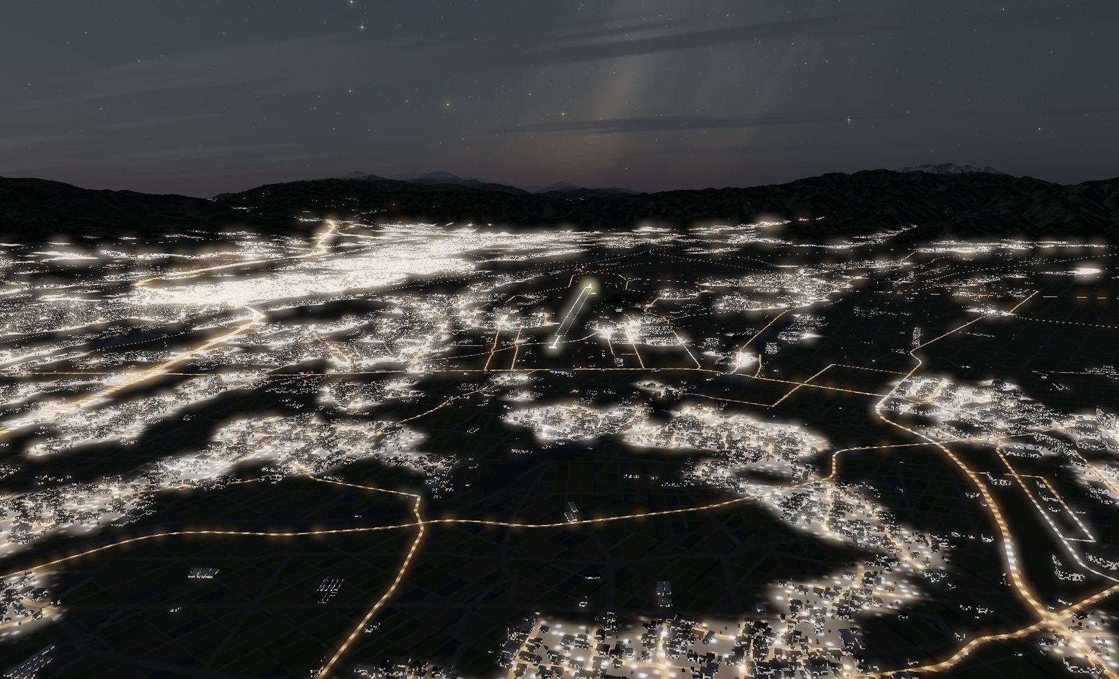
Matsumoto Airport
657 m above sea level — the highest airport in Japan with scheduled service. Ringed by 3,000 m peaks, no ILS, and only 2,000 m of runway.
DATA
- Identifier
- RJAF / Shinshu Matsumoto Airport
- Runway
- RWY 18/36 — 2,000 m × 45 m
- Elevation
- 657.5 m — highest scheduled-service airport in Japan
- Approach
- No ILS — the surrounding peaks rule it out
RNP-AR curved approach since July 2020 - Airlines
- Fuji Dream Airlines / Japan Airlines
- Area built
- 17.8 × 21.7 km
- Buildings
- 132,860
Thin air, a short runway, and mountains on both sides. The only civil airport in the game, and the only high-elevation one.
The real airport
Matsumoto, Nagano prefecture. At 657.5 m this is the highest airport in Japan with scheduled service — 285 m above the runner-up, Fukushima (372 m).
Because it is ringed by peaks of 1,500 to 3,000 m (the Northern Alps and Utsukushigahara), an ILS cannot be installed. Only in July 2020 did a GPS-based RNP-AR curved approach finally make operations reliable in poor weather. This is an airport you cannot come straight into.
There is one runway, RWY 18/36, 2,000 m × 45 m. No parallel taxiway, no turning pads.
The flight model scales thrust by air density. At 657 m that is about 9% less thrust, so both the take-off roll and the distance needed to stop grow. The difficulty of a high-altitude airport is not a special case here — it falls out of the equations.
The terrain we built
17.8 × 21.7 km, with measured elevations from 569 to 1,693 m.
There are 132,860 buildings — by far the most of any terrain in the game. Seen from above at night, the floor of the basin is lit from edge to edge.
The background ring reaches Okuhotaka-dake (3,190 m). Those are the real Northern Alps on the skyline.
What it is like to fly
This is an arrival, not a departure. 2,000 m is 700 m shorter than Matsushima, the air is thin, and there are mountains on both sides. With no ILS you come in visually from the north.
The basin floor is bright and everything around it is pitch black — Matsumoto at night puts you in a situation where the runway lights are the only information you have. The landing is not over until you stop.
The terrain included varies by edition and platform. See the description of each edition for details.
Elevation data: Geospatial Information Authority of Japan (GSI)